Nepal Now / Treks / Annapurna Circuit
Route guide · Annapurna
Annapurna Circuit Trek: Days, Cost, Difficulty and Best Season
The long walk round the Annapurna massif, over Thorong La, laid out stage by stage with the altitude of every night, what the road has changed, the permits you need and what it costs — sourced and dated.
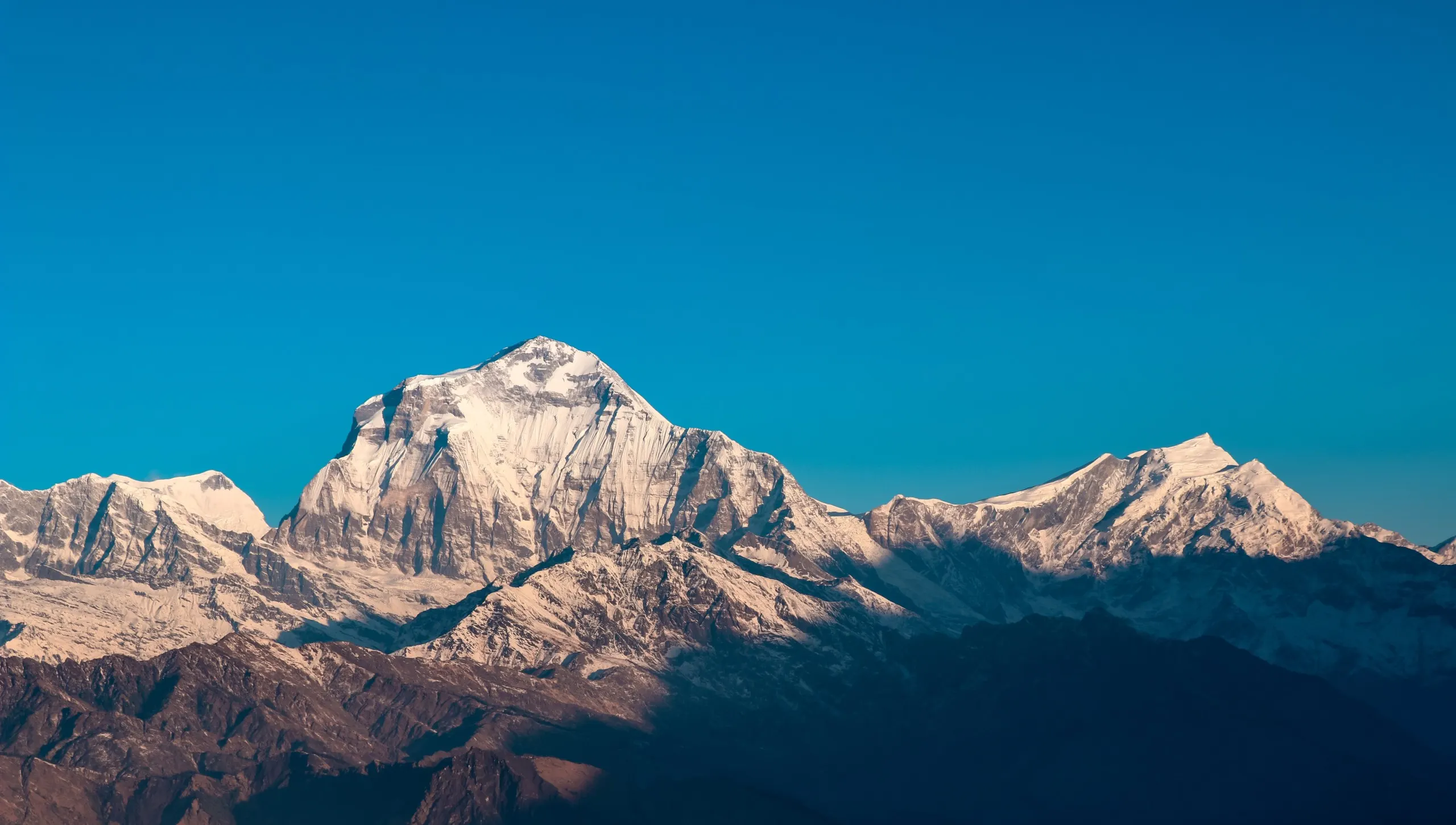
The route
The Annapurna Circuit walks round the Annapurna massif. It climbs the Marsyangdi valley from Besisahar through Chame and Pisang to Manang at 3,540 m, crosses Thorong La at 5,416 m, and drops into the Kali Gandaki through Muktinath, Kagbeni and Jomsom. Trekkers who keep walking follow the Kali Gandaki down to Tatopani and cross to Ghorepani and Poon Hill before Pokhara.
How long that takes is now a choice, because roads reach both ends. A 2015 diary calls it a route "that takes around 12-14 days walking". A 2016 report from the Mustang district authorities says "The Round-Annapurna Trekking is 21 days." A Christmas 2016 listing has trekkers "returning from their 3 weeks long Circuit trek" ending in Pokhara. Our comparison table uses 12–18 trekking days; the itinerary sets out one 14-day version.
Recorded · Manang · Motorcycle ride to Manang, Annapurna Circuit, May 25th 2015
Recorded · Thorong La · Shelter for tourists constructed at Thorang pass
Recorded · Pokhara · 5 Places To Visit in Nepal This Christmas 2016
How the road changed it
Two roads matter. On the Manang side a jeep road runs from Besisahar to Chame and on up the valley. A student group in late December recorded 6 hours by bus from Kathmandu to Besisahar, a local jeep reaching Chame "around 11 PM", and 9 hours for the drive back, during which "the local police were demolishing hills to expand the road". By 2020 a Manang page speaks of "the hugely improved road access to the valley".
Recorded · Chame · College Trip To Manang
Recorded · Manang · Lockdown Initiative / Reviving Highland Agriculture, Cuisine & Lifestyle
On the Mustang side the Beni–Jomsom road runs the length of the Kali Gandaki. An undated news item records "A fifty percent decrease in trekker numbers" since it came into operation, and a Narchyang–Muktinath trekking route built over five years to get walkers off it. A Swiss traveller who had walked the circuit three times before drove the road in July 2015:
"Now people want to go around the Annapurna in one week and do half of the distance by four wheel driven cruisers that run the route after the rains have stopped. During this time of the year we were about the only “crazies” on the road. Today Ghasa lodges have no more business as most trekkers ride past the small town to reach Thorong La (5400 Meter) faster."
— Swiss diary, July 2015, posted by Subhasini Shrestha
Recorded undated · Jomsom · New trekking route in Mustang comes into operation
Recorded · Ghasa · NEPAL IMPRESSIONS JULY 2015
A September 2015 piece is blunter: "such unplanned road construction has claimed many exciting trekking trails, most notably in the Annapurna region". The ACAP figures in the archive show 69,000 third-country trekkers in 2015 against 109,000 in 2014, though 2015 was also the earthquake year, so the road is not the whole story.
Recorded · Ruby Valley · A PIECE OF RUBY FROM RUBY VALLEY
Recorded undated · Annapurna Conservation Area · Majority of tourists from third countries in the ACAP region
Manang
Manang is 3,540 m by survey; the archive's travellers give 3,560 m and 3,650 m. A rider in May 2015 found the "next 30 kilometers to Manang" from Chame "not so steep", with a flat stretch past the airstrip at Humde "some 10 kilometers from Manang". An undated photo story counts "about 500 flat-roofed houses separated by narrow alley ways", with the summits of Annapurna and Gangapurna less than 8 km away.
"Annapurna dominating over Manang. It is truly majestic in every sense…normally we observe nature. Here we experience it, because the effect of it is so powerful it touches a person beyond just the eyesight."
— Alan Wittner, May 2015, posted by Dave Rankine
Recorded · Manang · Motorcycle ride to Manang, Annapurna Circuit, May 25th 2015
Recorded undated · Manang · Adventure Manang - Photo Story
Above Manang the trail leaves the road. "As we left the smoky, stony huddle of Manang below us, we hit the high single-track that leads to Yak Karkha", a 2016 mountain-bike diary records. Manang is also where the Tilicho Lake side trip leaves the circuit, 3 hours' walk to Khangsar.
Recorded · Manang · Riding Annapurna Circuit
Recorded · Khangsar · Trekking to Tilicho : From my ACAP diary
Thorong La day
Every crossing in the archive starts in the dark. A diary posted in January 2016 spent the night at "Thorung La Base Camp" and rose for "a two-hour ascent to the highest point in our Himalayan trek":
"We rose at 3 am in the deafeningly silent night. Only our headlamps lit the path ahead of us, as we slowly placed one foot infront of the other while creeping up the hill. Inhale. Exhale. Stop. I remember the moon lighting our way to the top with the bells of mule trains ringing in the distance."
— thirdeyemom.com diary, posted by Supriya Rai, 2016-01-21
Recorded · Thorong La · Trekking to the world's largest pass: Thorung La
The Dutch Climbing and Mountaineering Club reached the pass at 10:00 on 23 November 2015 and met few other hikers. Phil Evans, photographed on his 11th crossing that month, wrote that it "never gets any easier, but today was the best weather I’ve experienced on there. Lucky really as it looks like a storm blowing in this afternoon."
Recorded · Thorong La · Annapurna Circuit Trek Dutch Climbing and Mountaineering Club
Recorded · Thorong La · Photo Story - Thorong La
The pass has a record of its own. In October 2014 a snowstorm killed 43 people on Thorong La. ACAP's note on the measures that followed blames "the lack of weather forecast and tourists trekking without proper guides", and points out that "there are no settlements on the 15 km route from Manangs Thorung La Pass to Mustangs Muktinath". Two shelters were built at the pass for NPR 4 million by the Mustang District Development Committee and Nepal Tourism Board, reported in April 2016, and ACAP set up check posts at Muktinath that log trekkers and hand out a week-long forecast. The archive gives the pass as 5,416 m in most places, 5,400 m in one and 5,146 m in a Guardian photo item; 5,416 m is the survey figure.
Recorded undated · Muktinath · New safety measures on Annapurna trekking route
Recorded · Thorong La · Shelter for tourists constructed at Thorang pass
Recorded undated · Thorong La · Annapurna Circuit on 'Top 10 Travel Photos' by Guardian
Muktinath, Kagbeni and Jomsom
Muktinath (3,800 m) has "a big tourist village now with plenty of rooms and lodges", the July 2015 rider found. From there the archive gives "15 kilometres or 5 hours" to Jomsom "with much of it along roads"; Heather Farish walked it in June 2015 and "saw one bus, one jeep, two motorbikes and one trekker going in the opposite direction". Kagbeni, at 2,800 m and "a further 2-3 hours walk from Jomsom", is the gate to Upper Mustang; the archive's advice is to stay the extra night.
Recorded · Muktinath · NEPAL IMPRESSIONS JULY 2015
Recorded · Jomsom · Ke Garne! (What to do)
Recorded · Kagbeni · Kagbeni : Stay the extra night
Jomsom has "the only permanent airport in Mustang", a 20-minute flight from Pokhara. Wind means "the only available flights are usually morning flights", and in June 2015 there were none for two days. Marpha, whose apples the diaries mention, is 1.5 hours' walk further down.
Recorded undated · Jomsom · Post Earthquake Mustang Trek Update
Recorded · Marpha · Trip to Mustang- An incredible Journey
Day by day
Full itinerary and variations →| Day | Stage | Sleep | High point | Hours | km |
|---|---|---|---|---|---|
| 1 | Kathmandu → BesisaharA December student group recorded 6 hours by bus to Besisahar, then a local jeep on to Chame the same night. | 760 m | 760 m | 6 by road | — |
| 2 | Besisahar → Chame71 km of road. The archive records ice on this road in late December, hillsides being cut back to widen it, and 9 hours for the return drive. | 2,670 m | 2,670 m | 6–9 by jeep | — |
| 3 | Chame → PisangPast the rock wall a 2015 rider calls the Gateway to Heaven. A student group took almost 6 hours to Lower Pisang. | 3,200 m | 3,200 m | 5–6 | 14 |
| 4 | Pisang → ManangValley floor, nearly flat; the Humde airstrip lies about 10 km before Manang. The archive gives 30 km from Chame to Manang. | 3,540 m | 3,540 m | 5–6 | 16 |
| 5 | Manang → Manang (acclimatisation)Walk high, sleep low. The archive records a 3-hour walk to Khangsar on the Tilicho side and Gangapurna Lake frozen in late December; it holds no survey figure for the day-walk high points, so the village height is shown. | 3,540 m | 3,540 m | 3–5 | 6 |
| 6 | Manang → Yak KharkaHigh single-track above the village, as a 2016 rider describes it. A short day on purpose. | 4,050 m | 4,050 m | 3–4 | 10 |
| 7 | Yak Kharka → Thorong PhediSome groups continue to High Camp (4,850 m) to shorten the pass day; the night is higher and colder. A 2016 diary records a sleepless, freezing night at the base camp. | 4,540 m | 4,540 m | 3–4 | 6 |
| 8 | Thorong Phedi → Thorong La → MuktinathStart around 3 am. Two shelters were built at the pass in 2016 after the October 2014 storm. No settlement on the 15 km from the pass to Muktinath, as ACAP recorded it. ACAP check post at Muktinath. | 3,800 m | 5,416 m | 8–10 | 20 |
| 9 | Muktinath → KagbeniGateway to Upper Mustang; the Kag Chode monastery is 500 years old. The archive suggests staying the extra night. | 2,800 m | 3,800 m | 3–4 | 10 |
| 10 | Kagbeni → Jomsom → MarphaKagbeni is 2–3 hours from Jomsom and Marpha 1.5 hours beyond, much of it on the road. Jomsom has the only permanent airport in Mustang; wind limits flights to mornings. Many trekkers end here and fly or drive to Pokhara. | 2,670 m | 2,800 m | 4–5 | 16 |
| 11 | Marpha → TatopaniThe Beni–Jomsom road. A July 2015 diary describes the Tatopani–Ghasa stretch climbing from 1,100 m to over 2,000 m in 20 km along the gorge. Landslides closed the road at Tatopani in May 2015 and beyond Beni in July 2015. | 1,190 m | 2,670 m | 5–7 by road | — |
| 12 | Tatopani → GhorepaniHot springs at Tatopani, then the longest climb of the walk-out. Around three dozen hotels in Ghorepani as of January 2017. | 2,860 m | 2,860 m | 7–8 | 17 |
| 13 | Ghorepani → Poon Hill → Nayapul → PokharaPre-dawn climb to Poon Hill, then stone steps down through Ulleri to Nayapul and 50 km by road to Pokhara. Diaries record the descent as harder on the knees than the climb. | 910 m | 3,210 m | 7–8 | 18 |
| 14 | Pokhara → KathmanduThe archive gives 6 hours by road, 4–5 by tourist bus. Keep a spare day before an international flight. | 1,400 m | 1,400 m | 6–7 by road | — |
Altitude
Manang, at 3,540 m, is where the circuit's acclimatisation happens. It is the one village on the route the archive describes as "above 3,000 m", with a single growing season. The stages above it gain about 500 m a day: Yak Kharka 4,050 m, Thorong Phedi 4,540 m, and High Camp 4,850 m if you go on. The archive holds no diary of the Manang rest day, or of the Yak Kharka and Phedi stages; what it holds is the pass night and the pass morning. The altitude page sets out the profile day by day.
Recorded · Manang · Lockdown Initiative / Reviving Highland Agriculture, Cuisine & Lifestyle
A diary posted in January 2016 spent "a sleepless, cold night at Thorung La Base Camp to acclimatize", a night "so freezing that I had to empty my rucksack and layer on dirty clothes", then rose at 3 am for a two-hour ascent to 5,416 m. The mountain-bike race that follows the same route describes "A 5km hike a bike starting in the dark, through snow and freezing temperatures" to the top, after which "invariably deep snow makes the 6km descent from the top treacherous and slow going".
Recorded · Thorong La · Trekking to the world's largest pass: Thorung La
Recorded · Thorong La · Yak Attack Nepal
A rider in May 2015 put the medical side simply: "Altitude sickness can be an issue at Thorung La pass, but fast descend to lower elevation should take care of the problems." The site's own FAQ says the same at more length: with "headaches, shortness of breath, fatigue, nausea, inability to sleep, swelling of the face, hands and feet and loss of appetite, descend to a lower elevation immediately, and seek medical help." A May 2016 comparison piece quotes UK NHS guidance: with mild symptoms go no higher for 24 to 48 hours; if they worsen, descend by at least 500 m. A 2016 list of trekking problems adds "Do not ascend too quick and take short breaks" and records that "Medics suggest taking Diamox pills".
Recorded · Thorong La · Motorcycle ride to Manang, Annapurna Circuit, May 25th 2015
Recorded undated · Kathmandu · FAQ
Recorded · Annapurna Base Camp · Should you do ABC or EBC?
Recorded · Nepal · 5 problems you might encounter while trekking
Two diaries show what the early signs look like on this side of the range. A trekker at Singenge Dharamshala, 3,280 m, on the Nar Phu branch off the circuit: "my hands and feet were tingling, I had a slight headache, my fingers and certain other extremities had gone purple, to top it all off, my appetite had plummeted." A 77-year-old on an eight-day Annapurna trek "found the trek to be a lot harder than expected despite undertaking a rigorous training regimen to cope with the high altitude." On the Tilicho side, a first-time trekker's companions set the pace for her: "Walk like a turtle and rest like a rabbit."
Recorded · Singenge Dharamshala · Trekking to NarPhu Valley , Nepal
Recorded · Annapurna region · 77 year old treks Annapurna to raise money for Alzheimers Australia
Recorded · Tilicho Base Camp · Trekking to Tilicho : From my ACAP diary
Read the altitude sickness guide before you book, and keep the Manang day in any itinerary an operator offers you. The difficulty page covers the rest of what makes the pass day hard.
When to go
The archive's circuit crossings sit in the two main seasons, and its road diaries fill in the rest of the year.
Autumn is the peak, and the record shows both sides of that. The Dutch Climbing and Mountaineering Club walked the circuit from 12 to 26 November 2015: "That trail was in a good condition, but there were only a few other hikers at that trail." Phil Evans had "the best weather I’ve experienced" on his 11th crossing that November, with a storm blowing in by afternoon. A couple on the Annapurna trail at Tihar that year found the trails "not that busy". The other side is October 2014, when a snowstorm killed 43 people on Thorong La: "October being a peak trekking season coupled with the lack of weather forecast and tourists trekking without proper guides led to one of the highest casualties ever recorded in the ACAP region." Shelters at the pass and check posts at Muktinath issuing a week-long forecast followed.
Recorded · Thorong La · Annapurna Circuit Trek Dutch Climbing and Mountaineering Club
Recorded · Thorong La · Photo Story - Thorong La
Recorded · Annapurna region · Front Row to the Mountains
Recorded undated · Thorong La · New safety measures on Annapurna trekking route
Spring is the second window. A March 2016 piece calls "the months between February and May a perfect time to go for a spot of trekking", with rhododendrons, and in the same breath: "nothing is guaranteed in the Himalayas, despite latest weather apps or even your experienced guide telling you different." Mountain bikers snowed in at Tilicho Base Camp rebooked for April, "when it would be peak climbing season again". At the end of May a rider slept at Manang with "Temperature around zero degrees" and woke to "a crystal clear sunny day".
Recorded · Annapurna region · Spring blooms in Annapurna
Recorded · Tilicho Base Camp · Riding Annapurna Circuit
Recorded · Manang · Motorcycle ride to Manang, Annapurna Circuit, May 25th 2015
Winter is recorded from the Manang side only. A student group in the last week of December found "the ice had covered the road and jeep couldn’t drive on that", Gangapurna Lake frozen, and "icy water and dusty winds". A backpacker reports lows of -17°C at 4,000 m on the circuit. Humde, at 3,200 m below Manang, hosted an ice climbing festival from 1 to 10 February 2020. Nothing in the archive describes Thorong La in winter, or says when it closes.
Recorded · Manang · College Trip To Manang
Recorded · Annapurna region · Find out why Nepal should be Your Next Backpacking Destination
Recorded · Humde · 2nd Annual Ice Climbing Festival
Monsoon is different on the two sides of the pass. A Swiss couple who rode the Beni–Jomsom road in July 2015 found the Ghasa stretch "a washed out river bed" and then, at Lete, "the rain barrier. The big massive mountains of Annapurna and Dhaulagiri block here the clouds and rains are more scarce." Beyond Lete "the valley opens up and slowly turns into a desert". A 2019 Nepal Tourism Board piece says Upper Mustang "cannot look better in any other season beside monsoon". Jomsom's wind means "the only available flights are usually morning flights"; in June 2015 there were none for two days, and the Tara Air Twin Otter from Pokhara to Jomsom crashed on 24 February 2016 with 23 on board. One 2016 list sums the region up as "the wettest, driest, and windiest places in Nepal".
Recorded · Lete · NEPAL IMPRESSIONS JULY 2015
Recorded · Upper Mustang · Enjoy the Monsoons in the Himalayas
Recorded undated · Jomsom · Post Earthquake Mustang Trek Update
Recorded · Jomsom · Ke Garne! (What to do)
Recorded undated · Myagdi · Tara Air enroute Pokhara-Jomsom crashes killing all 23 on board
Recorded · Annapurna region · 12 Reasons why Nepal should be on your travel Bucket List
Our comparison table gives October–November and March–April. The best time page sets out the months for this route; the best time to trek guide covers Nepal as a whole.
Permits
The circuit needs two documents: an Annapurna Conservation Area (ACAP) entry permit and a TIMS card. Both are checked on the trail. After the 2014 storm ACAP set up check posts at Muktinath that "log in trekkers", and keeps "Data on Nepali visitors" at Manang.
Recorded undated · Muktinath · New safety measures on Annapurna trekking route
The archive records two ACAP fees, and they disagree. A January 2017 report on Ghorepani–Ghandruk visitor numbers says "the entry fee for people from other foreign countries is Rs 2,000 each", with NPR 200 for SAARC citizens. An undated news item on 2015 ACAP arrivals says "permits to trek in ACAP region cost RS 2000 per person for SAARC tourists while the same permits cost RS 4000 per person for tourists from third countries." We cannot reconcile the two from the record.
Recorded · Ghandruk · Ghorepani Ghandruk Sees Increment in the Number of Tourists
Recorded undated · Annapurna Conservation Area · Majority of tourists from third countries in the ACAP region
The TIMS card, per the site's own FAQ, cost "20 US $ equivalent Nepalese Rupees" for Free Individual Trekkers "who do not take the services of both Guide and Porter" and "10 US $ equivalent Nepalese Rupees" for group trekkers through a registered agency. It needs "a photo copy of your passport details and two passport-size photographs", is "valid only for one entry for prescribed area and duration", and came from Nepal Tourism Board or TAAN counters in Kathmandu and Pokhara.
Recorded undated · Kathmandu · FAQ
The archive holds no permit figure after January 2017. For 2026 the only Annapurna-specific line in the guide pages we read gives "ACAP permit: $25" and "TIMS card: $8.35" in a July 2026 article; treat those as one publisher's figures, not the official schedule.
Quoted · 10Adventures · A Guide to the Best Treks in Nepal
On guides: a Nepal Tourism Board update of 11 August 2015 confirmed "the government has not made any mandatory restrictions regarding accompanied trekking for Free Individual Trekkers (FITs)". That is the archive's last word. A guide page updated in August 2026 records that "In April 2023 the Nepalese Tourist Board announced that guides would be mandatory" and that "There are plans (in theory at least) to start enforcing the new rule in 2024"; see the solo trekking rules. Check the current rule and both fees with ACAP or your operator before you travel.
Recorded · Kathmandu · Nepal Now news update, 11 August 2015
Quoted · Horizon Guides · Trekking in Nepal
The permits page lists what to carry; the trekking permits guide covers every region.
Cost
The archive's circuit prices are from 2015 and 2016, and there are few of them. Getting to the trailhead in October 2015: "the best option was a private car for about $200" from Kathmandu to Besisahar, or three seats in a shared minibus "confirmed for RS 4500". A room at Tal came "with hot shower for RS 400". On the lodges themselves: "The teahouses all use the same menus, with set prices, this is to stop profiteering. Of course this doesn’t stop there being variations in the quality of the food."
Recorded · Besisahar · Trekking to NarPhu Valley , Nepal
A 2016 backpacker's rule of thumb for teahouse trekking was "$15-25 a day" for food, room and "the occasional beer". A May 2016 comparison of the two base camps counts the Lukla flight, "about US$330", as a cost the Annapurna side avoids because "trailheads can be easily reached by bus and car". An October 2015 Lonely Planet summary noted "discounts on hotels/airfares/permits" while tourism was down by half after the earthquake.
Recorded · Nepal · 10 reasons to hike in Nepal
Recorded · Annapurna Base Camp · Should you do ABC or EBC?
Recorded · Kathmandu · Why is Nepal Now the perfect time for trekking?
We hold no 2026 operator quote for the Annapurna Circuit. The cost table we compiled in August 2026 covers Everest Base Camp; its only Annapurna line is the ACAP permit at "$25" in a July 2026 guide. We do not borrow Everest package prices for this route. The cost page will carry Annapurna quotes as we collect them; the Nepal trek cost guide explains what a package price usually includes.
Quoted · 10Adventures · A Guide to the Best Treks in Nepal
Compared with the alternatives
All 13 routes →| Annapurna Circuit | Everest Base Camp | Annapurna Base Camp | |
|---|---|---|---|
| Trekking days | 12–18 | 12–14 | 7–11 |
| Highest point | 5,416 m (Thorong La) | 5,545 m (Kala Patthar) | 4,130 m (Annapurna Base Camp) |
| Highest night | 4,540 m (Thorong Phedi; High Camp 4,850 m optional) | 5,140 m (Gorak Shep) | 4,130 m (Annapurna Base Camp) |
| Difficulty | 3 · Demanding | 3 · Demanding | 2 · Moderate |
| Getting there | Road to Besisahar or Chame; out by road or flight from Jomsom | Flight to Lukla | Road from Pokhara to Nayapul, Ghandruk or Jhinu |
| Lodges | Teahouse every night | Teahouse every night | Teahouse every night |
| Permits | ACAP + TIMS | SNP + Khumbu RM | ACAP + TIMS |
| Guide required | Yes since April 2023 in ACAP as recorded by operators; check | Not for EBC (Khumbu is outside the 2023 rule as applied by the municipality); most trekkers hire one | Yes since April 2023 in ACAP as recorded by operators; check |
From the record
-
Annapurna Circuit of Nepal in top 10 Places by Lonely Planet
“Annapurna Circuit of Nepal has been included in the list of 10 destinations to visit by the international travel site Lonely Planet this year.”
Recorded · an unnamed contributor
-
Nepal Tourism Board Announces Holiday Packages Targeting Domestic Tourists
“The number of sightseers travelling from Beni to Jomsom by motorcycles has also risen sharply after the construction of the road.”
Recorded · Isha Balla
-
Shelter for tourists constructed at Thorang pass
“The shelter has been constructed at a cost of 4 million rupees supported and contributed by the District Development Committee, Mustang and Nepal Tourism Board.”
Recorded · Isha Balla
-
“The Annapurna circuit is one of the Planet’s great hiking routes and is surprisingly seldom ridden, but with huge potential. Cuan had hiked it twice and his obsession with riding it rubbed off on me.”
Recorded · Supriya Rai
-
Trekking to the world's largest pass: Thorung La
“After a two-hour ascent to the highest point in our Himalayan trek we would cross the pass, that stands at an intimidating 5416 m.”
Recorded · Supriya Rai
-
Annapurna Circuit Trek Dutch Climbing and Mountaineering Club
“On November 23th 2015 at 10 hrs we reached theThorung-La 5416m with our group of the Dutch Climbing and mountaineering Club.”
Recorded · Subhasini Shrestha
-
“Today Ghasa lodges have no more business as most trekkers ride past the small town to reach Thorong La (5400 Meter) faster.”
Recorded · Subhasini Shrestha
-
“an assessment team was dispatched from June 25 to July 2, 2015 to this region to observe and record seismic damages that occurred along the main trekking routes and select villages”
Recorded undated · an unnamed contributor
Going with an operator
The diaries do not argue for or against an operator; they show what one did. On the Nar Phu branch, "Late yesterday our guide Lillee arrived from Pokhara" and "arranged for us to squeeze in the 4×4 twincab with some locals" for the Besisahar road. On the Tilicho side a first-timer's companions "reminded me that we’re not in a tournament. Walk like a turtle and rest like a rabbit. They wouldn’t let me give up."
Recorded · Besisahar · Trekking to NarPhu Valley , Nepal
Recorded · Tilicho Base Camp · Trekking to Tilicho : From my ACAP diary
Heather Farish, walking Jomsom to Muktinath with her guide Mingmar in June 2015 when the lodges were empty, made the economic case: "Hiring a guide, eating at restaurants and staying in guesthouses not only provides employment and income directly but these people usually support an extended family." The site's own FAQ put the practical one: "You’ll find it easier to work with a reputable agency to help with any permits and TIMS etc that you’ll need for trekking areas."
Recorded · Jomsom · Ke Garne! (What to do)
Recorded undated · Kathmandu · FAQ
The safety case is in ACAP's note after October 2014, which names "tourists trekking without proper guides" among the causes of the 43 deaths on Thorong La. Against that, the archive's last word on rules is the Nepal Tourism Board's 11 August 2015 update: no "mandatory restrictions regarding accompanied trekking for Free Individual Trekkers". What has changed since is covered in the solo trekking rules.
Recorded undated · Thorong La · New safety measures on Annapurna trekking route
Recorded · Kathmandu · Nepal Now news update, 11 August 2015
We name no operator here. The operators page lists the questions to ask any of them; choose a trekking operator and guide vs porter cover the rest.
Questions people ask
How many days does the Annapurna Circuit take?
Between 12 and 18 trekking days in our comparison table, and the archive shows why the range is wide. A 2015 diary calls it "around 12-14 days walking"; a 2016 district report says "The Round-Annapurna Trekking is 21 days"; a July 2015 rider found that "people want to go around the Annapurna in one week and do half of the distance by four wheel driven cruisers". A guide's comparison published in August 2026 gives 10–12 days. The difference is how far you ride: to Besisahar, to Chame, or on to Manang, and whether you fly from Jomsom or walk out over Poon Hill.
Recorded · Manang · Motorcycle ride to Manang, Annapurna Circuit, May 25th 2015
Recorded · Thorong La · Shelter for tourists constructed at Thorang pass
Recorded · Ghasa · NEPAL IMPRESSIONS JULY 2015
Quoted · BestHike, guest post by Mohan Raj Bhandari (North Nepal Travel & Trek) · Which Nepal Trek Suits You? A Local Guide's Comparison
How hard is Thorong La?
It is a 5,416 m pass crossed in one day from Thorong Phedi (4,540 m) or High Camp (4,850 m), starting around 3 am, with "a two-hour ascent to the highest point" from the base camp and "no settlements on the 15 km route" from the pass to Muktinath. Phil Evans, on his 11th crossing, wrote that it "never gets any easier". The 2014 storm that killed 43 people happened here in peak season. The walking is not technical; the altitude, the cold and the length of the day are the difficulty. See difficulty and the difficulty guide.
Recorded · Thorong La · Trekking to the world's largest pass: Thorung La
Recorded undated · Thorong La · New safety measures on Annapurna trekking route
Recorded · Thorong La · Photo Story - Thorong La
Can you do the Annapurna Circuit without a guide?
The archive's last word is a Nepal Tourism Board update of 11 August 2015: no "mandatory restrictions regarding accompanied trekking for Free Individual Trekkers". Its FAQ issued TIMS cards to independent trekkers "who do not take the services of both Guide and Porter". ACAP's note after the 2014 storm names "tourists trekking without proper guides" among the causes. A guide page updated in August 2026 records that "In April 2023 the Nepalese Tourist Board announced that guides would be mandatory"; the archive holds nothing on it. Read the solo trekking rules and check before you go.
Recorded · Kathmandu · Nepal Now news update, 11 August 2015
Recorded undated · Kathmandu · FAQ
Quoted · Horizon Guides · Trekking in Nepal
Has the road ruined the Annapurna Circuit?
The record says it changed it, and hurt the villages the road bypasses. "Today Ghasa lodges have no more business as most trekkers ride past the small town", a July 2015 diary says; an undated news item records "A fifty percent decrease in trekker numbers" since the Beni–Jomsom road opened, and a five-year project to build a Narchyang–Muktinath walking route away from it; a September 2015 piece says road building "has claimed many exciting trekking trails, most notably in the Annapurna region". The same record has the "high single-track" above Manang in 2016, the pass day unchanged, and Lonely Planet listing the circuit among its 10 destinations for 2020. The road is where you choose to ride.
Recorded · Ghasa · NEPAL IMPRESSIONS JULY 2015
Recorded undated · Jomsom · New trekking route in Mustang comes into operation
Recorded · Ruby Valley · A PIECE OF RUBY FROM RUBY VALLEY
Recorded · Manang · Riding Annapurna Circuit
Recorded · Annapurna region · Annapurna Circuit of Nepal in top 10 Places by Lonely Planet
Which direction should you walk the Annapurna Circuit?
Every crossing in the archive goes the same way: up the Marsyangdi through Manang and over Thorong La to Muktinath. The Dutch club, the January 2016 diary, the Yak Attack race and the rider who found the 30 km from Chame to Manang "were not so steep" all went that way. The record holds no clockwise crossing, so we cannot compare the two. Read the itinerary with that in mind.
Recorded · Thorong La · Annapurna Circuit Trek Dutch Climbing and Mountaineering Club
Recorded · Manang · Motorcycle ride to Manang, Annapurna Circuit, May 25th 2015
Recorded · Thorong La · Yak Attack Nepal
Everest Base Camp or the Annapurna Circuit?
The circuit is a road trailhead and a pass; Everest Base Camp is a flight and a high valley. The archive's 2016 comparison of the two base camps counts the Lukla flight at "about US$330" against trailheads "easily reached by bus and car". Everest sleeps higher (Gorak Shep at 5,140 m against Thorong Phedi at 4,540 m); the circuit's high point is a pass you cross once. A guide's August 2026 comparison puts it this way: "If you have two weeks and want the name: Everest Base Camp, done slowly. Ten days and you want variety: the Annapurna Circuit." See Everest Base Camp, all routes compared and choose a trek.
Recorded · Annapurna Base Camp · Should you do ABC or EBC?
Quoted · BestHike, guest post by Mohan Raj Bhandari (North Nepal Travel & Trek) · Which Nepal Trek Suits You? A Local Guide's Comparison